
gulredrel
-
Posts
1116 -
Joined
-
Last visited
Content Type
Profiles
Forums
Events
Posts posted by gulredrel
-
-
49 vs. 51 % Looks like no real preference

-
 1
1
-
-
That needs more practice, wrong dive angle, missed speed and altitude... Or do the WPs behave so much different from HE rockets?

-
No problem. Just wanted to do this flight anyway, Doing some VOR navigation radial flying and using the TACAN to receive the DME ranging info.
So I now know I need to have the extra fuel in the current state.
-
And an update for completeness of data. Did the same flight with the EB version.
Started with 1980 lbs fuel regarding mission editor.
The fuel warning light came on as the fuel flow meter showed a total used fuel of 1540 lbs. Fuel gauge was roughly showing 400 lbs fuel left.
Shortly after landing, fuel totalizer showed 1600 lbs of used fuel, fuel pressure warning came on and the engine quit. Fuel gauge showed around 300 lbs of remaining fuel.
Here is the corresponding track file: 20231210_C-101EB_fuel_empty_on_taxi_back.trk
Regarding the manual, the low fuel warning comes on at around 370 lbs remaining fuel. Being near the airport, this amount should be sufficient to do a missed approach and a circuit, landing and taxi back to the parking space.
Thanks
Jens
-
It's operator specific, but I think we can agree, regardless of where the jettison chute area is, there is someone collecting it in a short period of time to not interfere with further aircraft.
So for the game and different aircraft using the drag chute we could pretend, the dropped chute object should be removed after x amount of time. Maybe 30 - 60 seconds?!
-
1
-
-
I've put such a TACAN frequ. pairing sheet in the saved games kneeboard folder, so it will be available on any map and aircraft.
-
1
-
-
Caucasus map only has VORs without DMEs.
In South Atlantic there are some real VOR/DME stations. For example Punta Arenas on 114.100 MHz. Corresponding TACAN frequency is 88X.
In C-101EB, you can tune VOR for the heading information and TACAN:
Or in C-101CC (which does not has TACAN) you can tune just 114.10 MHz and setting DME on the VOR receiver to get heading and ranging information.
Doing the same in MB-339 you can also receive the ranging information with 88X on the TACAN receiver and have the 114.10 MHz on the VOR. Problem is, HSI will only show either heading information, when VOR is selected as NAV source (large picture below, heading, but distance indicator striped with no indication) OR ranging information, when TACAN is selected as NAV source (inset picture below, I'm less than a mile away from the VORDME, so it shows 0 NM). You can't have both at the same time.
But as MB-339 has GPS/INS system, you can show distance information on one of the data pages of the NAV display.
-
2
-
-
@Vibora: Thanks for investigation.
Here you go with the trk file: 20231203_C-101CC_fuel_empty_on_taxi_back.trk
Also some screens taken from the cockpit yesterday.
Fuel flow gauge and fuel gauge after engine went out.
-
Hello,
back from a flight in the C-101CC where fuel warning came on short after a touch and go. Went around, landed and during taxiing back, fuel pressure warning came on first flickering and shortly afterwards was solid and the engine quit.
I started my flight with 1980 lbs of fuel regarding to mission editor. With the engine quitting during taxi, the fuel totalizer showed 1400 lbs of used fuel. The fuel gauge showed around 200 lbs.
Haven't found something in the manual regarding usable fuel and reliability of the fuel totalizer or the fuel gauge.
What should be taken into account for fuel planning if neither the fuel gauge nor the totalizer is showing accurate data?! What amount of fuel needs to be considered as not usable?
I have the track file, but it's 6.7MB large and you would need to watch more than an hour of just a scenic flight in SA map.

Thanks
Jens
-
That's not specific to L-39, it's a general DCS issue, where everything else than concrete or asphalt is like muddy glue. Don't know if this will change or not.
Grass airfields on WWII maps should work. I have no idea how the terrain characteristics are modeled.
-
Voted for sticking with the satellite imagery. Don't think that popularity of the map will rise when changing everything to hand crafted textures.
I like the latest performance improvements. This and maybe creating more local assets is what the resources should go into.
edit: That's just looking great as it is:
-
5
-
-
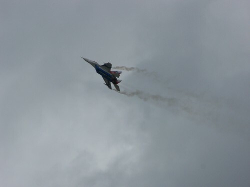
Punta Arenas training sortie.
Puerto Natales - Aeropuerto Teniente Julio Gallardo
-
5
-
-
Thanks, no more jittering for the trains.
Trains below railway on some maps and wheels not turning is an open issue, regarding the other thread.
-
10 hours ago, Flappie said:
Train stuttering was fixed. Trains wheel below railway are still yet to be fixed for Syria, Normandy and The Channel.
Is the issue with the wheels not turning also known issue / related to being below the tracks?
-
Currently there is no keybind available for that, but IFE is aware of it. See this thread for details.
-
 1
1
-
-
Hopefully this will get fixed soon:
"At the moment we are working to fix some annoying issues on the CDU and Custom Data Card and other issues related to the navigation, and we are finalising in parallel the flight director."
Has been said here:
-
2
-
-
+1 for this. I also would like to filter search results or search pre-filtered results. Anyway would do it.
-
1
-
-
Thanks, confirmed fixed, also tried it on my end some minutes ago.
-
1
-
1
-
-
Huge changelog, thanks for support, download in progress.
Looking forward to this next iteration of S-3B, B-52 and B-1B 3D model.
-
1
-
-
Here is how it works with the corresponding frequency range switching via far/near switch in Beslan
- first select the OM frequ. 250 kHz in the lowest frequ. range on the ARK-5 control panel
- check on the ARK-5 control panel, that in the highest frequency range 250 kHz corresponds to 1050 kHz (slight needle swing on radio compass)
- set frequency range back to the lowest on ARK-5 panel
- on the left, there are three switches. You need to select the highest for the third range
- now switching far / near switch you can see frequency range dial changes position without the change of the rotary on the ARK-5 panel
And the track from 2.9 MT, from which I created the video.
Regards
Jens
20231116_MiG-15_Beslan_OM_IM_near_far_frequ_range_change.trk
-
1
-
1
-
-
See derelor's description in one of the threads above. With the three switches on the left, you select the sub-range for near switch.
Need to correct my post above. The airport with B was not Batumi, but Beslan where it used to work. Maybe I can create a track to show case.
I don't know if there is a pdf or thread which lists the compatible airfields but these are not many. The maps and navigation aids do not match with how the nav aids were set up for an early cold war era airplane. L-39 has a more modern navigation set where you separately can tune frequencies for inner and outer NDB to be used with the near/far switch. MiG-19 has a work around, where you can set up different frequencies regardless if they match the position of the tuning crank in different sub frequency bands, like it needs to be in MiG-15.
Best is to only use one NDB and arrive at it at the runway heading.
-
I don't know, but there are only a few airfields in Caucasus, where the FAR/NEAR switching works.
You only set the FAR frequency, the near frequency than depends on the selected range. and the frequency is held into place. I think, it's
BatumiBeslan which is set up to work correctly with the outer marker frequency position matches the inner frequency position in the different range selected.Please see details here:
or here:
-
Great update, thanks for the continued work on the map.
-
3
-
-
Thanks for moving the thread.
Did a quick test with just the AI F1BE and me sitting on the ramp.
F1BE landed and released the chute after landing at mission time 08:05:46:
Plane arrived at parking spot: 08:10:34
Ended mission with plane parking and mission time: 08:22:28, chute was still on the runway around 17 min after releasing the chute.
Tested in MT 2.9, track attached.
-
1
-


Post your favorite F14 Screenshots here!
in DCS: F-14A & B
Posted
I see you...