drPhibes
-
Posts
1103 -
Joined
-
Last visited
-
Days Won
2
Content Type
Profiles
Forums
Events
Everything posted by drPhibes
-
Hmeymim = Bassel Al-Assad, so it's there, just listed under the wrong country. There were a few screenshots from Hmeymim on Ugra Media's website before it disappeared.
-
King Hussein Air College is in Jordan (Mafraq Air Base), and as far as I can see, the only Hatay in the area covered b the map is in Turkey. King Hussain Air College gives a good indication of how far south the detailed part of the map extends. The project description previously available at Ugra Media's now dead website mentioned Irbid and Jerash in the south, and Gaziantep in the North, so with a map size of 600x500km I'd expect it to go as far east as approximately Deir ez-Zor.
-
Qabr Al-Sitt air base: https://www.google.com/maps/place/33%C2%B027'30.0%22N+36%C2%B021'23.0%22E/@33.4580978,36.3574373,660m/data=!3m1!1e3!4m5!3m4!1s0x0:0x0!8m2!3d33.4583333!4d36.3563833
-
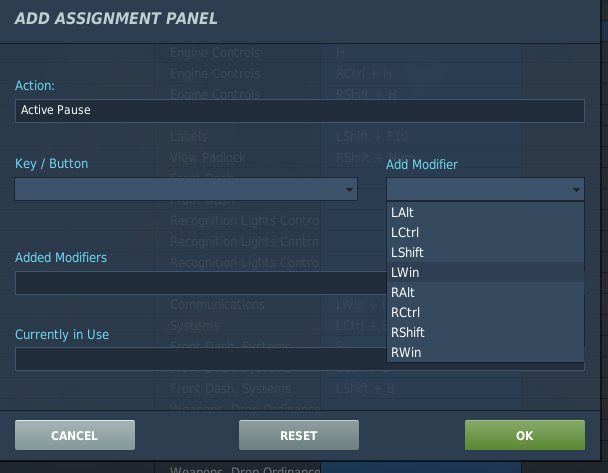
The Win buttons are available as modifiers, so this is a feature, not a bug.

-
Any kind of benchmark based on a piece of software that is in constant development (with frequent reports of performance changes from update to update) is completely worthless.
-
So Deka and/or ED should spend their valuable time changing parts of their software because a server admin doesn't listen to your "highly requested" (sic.) suggestions? Sorry to say so, but the world doesn't revolve around you.
-
Several of my friends who previously shot the original Shadow in IPSC Production have upgraded to the Shadow 2, and they all seem to be pretty pleased with it. The only real weak spot is the slide stop pin, which breaks on all CZ75s and derivatives (Tanfoglio etc) after a few thousand rounds.
-
Three.
-
Not quite getting RTFM on JSOW programming. ERASE function
drPhibes replied to DmitriKozlowsky's topic in DCS: F/A-18C
Noope... https://www.army.mil/article/225257/aces_fielding_upgrades_to_army_command_units -
The technical term for a TACAN without DME is "switched off" or "out of service". A TACAN works by amplitude modulating bearing info on the DME reply pulses.
-
Exchanging opinions is fine, but you have to realize that not all opinions have equal value. If I have to choose between what BIGNEWY or someone else from ED or a 3rd party dev. writes about the status of a project, or the uninformed opinions of people with no insight into the development of a module, I'll stick with the official news. I'm not pointing at anyone in particular here, but the ammount of Dunning-Kruger symptoms some users show in in these forums is borderline painful. Good thing I'm already a misanthrope...
-
There may be multiple development builds used for different stages of testing (e.g. a release candidate build and a devlopment build, and perhaps one for Vulkan testing and one for integration into a new smart toast iron), so the fact that you don't see a certain terrain in the mission creation dialog in a video demonstrating a new module means nothing.
-
Just out of curiosity, what did you think this message meant when you ordered?
-
ED - let the community create/update 3D models
drPhibes replied to nickos86's topic in DCS Core Wish List
There have been enough cases of attention seeking "modders" passing off ther peoples work as their own. Expecting people to be honest, especially on the internet, is unfortunately not a good idea. -
Missing ILS Signals @ Tonopah Test Range RWY 14
drPhibes replied to Flyingsix's topic in Bugs and Problems
Check your wind direction. The ILS is interlocked off if the wind direction dictates that a different runway direction is the active runway, or if the wind speed is too low. I tested it with a 10kt headwind (mission editor wind direction approximately 320°), and the ILS at TTR RWY 14 works fine in the F-16 with the latest OB release (2.5.6.47224). -
reported earlier Al Dhafra air base ILS issues
drPhibes replied to breakneckPace's topic in Bugs and Problems
108-111.975 MHz is the whole band allocated for the localizer. When the ILS standard was first defined in Annex 10, there were just 20 channels, starting at 108.1 and continuing up to 111.9 in odd decimal intervals. Later on, the channel width was made narrower, allowing 20 new channels at f+50kHz. The only invalid LOC frequencies in the PG map last time I checked was two runways at Al Dhafra and Bandar Abbas, so there are plenty of other runways where you can pratice ILS landings in the F-16. The frequency separation between carriers that you quote isn't really relevant. It relates to the spacing between the course (COU) and clearence (CLR) signals for dual frequncy localizers. In a dual frequency LOC, in addition to the main fan-shaped beam (COU, approx ±10° width) radiating from the loc array, you also have a CLR signal (±35° width, with a null at the center), whose only purpose is to give a full right or left deflection in the CDI when you are outside, but near, the coverage area of the COU signal. The frequencies are offset far enough apart to avoid any intermodulation problems between the two carriers, while still still remaining inside the channel width of the receiver. -
Do you have any plans of fixing the relevant beacons.lua entries as well? It has been reported multiple times in the PG bugs & problems section.
-
Those aren't valid localizer frequencies. The bug has been reported, but ED hasn't done anything about it yet.
-
Some nice new screenshots at helisimmer: https://www.helisimmer.com/news/new-screenshots-info-dcs-mi-24p
-
Publishing a template for a model where the 3d mesh may change enough for the template to be unusable is, to put it simply, not the best idea. Making a template twice because you prematurely published one is a waste of development resources. The fact that we got more than just the default livery in the latest update could be an indication that the model is in a state of completion where completing and releasing the template starts to make sense.
-
Pretty much everyone that doesn't land their F/A-18s on carriers have regular ILS receivers instead of ICLS. It all boils down to cost, space, weight and perceived usefullness. Obviously, the USN didn't see the need for an ILS receiver in addition to the ICLS.
-
Full fidelity (non-Flaming Cliffs) models with ILS: A-10C AV-8B (sort of; the AWLS channels are mapped to ILS frequencies through some .lua file) C-101 F-16C JF-17 Mirage 2000C UH-1H Other ILS equivalents: AJS-37: TILS F-14: ICLS F/A-18C: ICLS Mig-21: PRMG L-39C: PRMG
-
Check the "Planned F-16C Systems and Payloads" post.
-
Actually, all the navaids at Khasab in the sim are fictional, since there is no ILS there IRL, and there is no way you could install one with the geography of the area. The valley is way too narrow for there to be any chance of getting a usable localizer signal beyond the immidiate area around the airport.
-
That's incorrect. The TACAN specifications are publicly available, and have been so for decades. Although MOOG Inc. in Utah is probably the largest supplier of TACANs for the US and their allies, there is actuallt a TACAN manufacturer located in China (PRC, not TW). Several of the countries around the Persian Gulf (including Iran) have TACANs at their non-NATO airbases. Does Khasab have a TACAN IRL? I don't know (I haven't found a public AIP for Oman yet, and airbases are often not included in these anyway), but there is no reason why they couldn't, being an ally of the US. The current beacons.lua for the PG map is bugged, as documented in several other bug reports. If you want the TACAN back, and don't feel like waiting for ED to fix it, add the following to your beacons.lua file (note that it'll probably not be playable at servers that enforce the integrity check): { display_name = _('Khasab'); beaconId = 'airfield10_2'; type = BEACON_TYPE_TACAN; callsign = 'KSB'; frequency = 113700000.000000; channel = 84; position = { 667.781860, 15.763658, -91.611923 }; direction = 88.473189; positionGeo = { latitude = 26.177844, longitude = 56.240980 }; sceneObjects = {'t:-1265041393'}; };