drPhibes
-
Posts
1103 -
Joined
-
Last visited
-
Days Won
2
Content Type
Profiles
Forums
Events
Everything posted by drPhibes
-
https://forums.eagle.ru/showthread.php?t=273255
-
ILS for a RWY not always ON?
drPhibes replied to Razor18's topic in Aircraft AI Bugs (Non-Combined Arms)
To quote ICAO Annex 10 volume 1, the international standard for radio navigation aids: Generelly speaking, you'll never have ILS systems in both runway ends radiating at the same time. The problem with DCS is that the ILS interlock logic doesn't follow the active runway logic. A headwind of >7kts is required for the ILS to be activated, which is wrong. -
Yes. Here it is: https://www.google.com/maps/place/25%C2%B001'38.0%22N+55%C2%B023'44.0%22E/@25.0271713,55.3952908,254m/data=!3m1!1e3!4m5!3m4!1s0x0:0x0!8m2!3d25.0272222!4d55.3955556 Specifically, this is a VORTAC, where a TACAN is co-located with a DVOR. The TACAN antenna (e.g. dB Systems 900-series) sits on top of a fiberglass structure that typically covers the central alford loop antenna used for the DVOR carrier. The DVOR carrier atenna is the same type as the 48 sideband antennas, so it's very easy to differentiate between a VOR/DME and a VORTAC with decent aerial/satellite photos.
-
Isn't the L-39 multicrew?
-
There are around 200 in service according to Fight International's world air forces 2020 (I'd love to link to it, but it seems to have been put behind a paywall since the last time I checked it). Some may have been retired since waf2020 was published, but there are still many left.
-
Except when dealing with AI JTACs. Currently, there is no way of telling the JTAC which code to use. Fixing that issue is a prerequisite before removing the in-flight code change workaround.
-
If there is ILS at a site it's easy to add ICLS, since the coordinates of the beacons are already given in beacons.lua. Once the coordinates are known, all you need to do is to define a channel and frequency. Actually, I haven't checked if both a channel and frequency is necessary. The reason why I'm not sure of this is that the function for calculating calculating channel frequencies in DCS is 15415000000 + 30000000 * ((channel - 1) % 10), which wraps around after channel 10 (given by the modulo operator), giving the same frequency for channel 1 and 11, 2 and 12 etc. Adding a cmpletely new beacon requires more work, as described here. The process is the same for all landing aids (ILS, PRMG, ICLS): https://forums.eagle.ru/showpost.php?p=4490548&postcount=46 TonyG has made a similar mod for the Caucasus map: https://forums.eagle.ru/showthread.php?t=227653
-
Mine is 47GB. OB 2.5.6.55363
-
1st post updated with DL url.
-
You forgot to add "while carrying an underslund tetrapod or 40ft shipping container". The Mi-8 gets my vote.
-
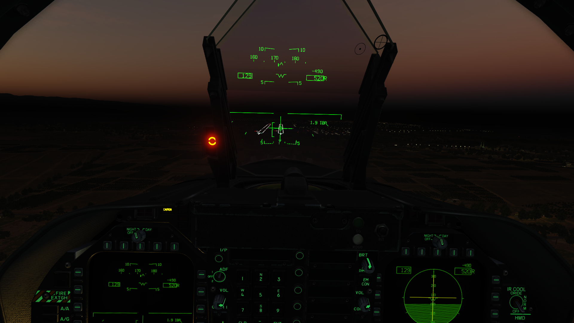
Progress report: All ICLS beacons have ben added. 6 out of the 11 beacons have been tested. Here's a screenshot of a test flight at Khmeimim/Bassel Al-Assad, RWY 17R:

-
Upgrade BRM90 rockets to the latest ED standard.
drPhibes replied to riojax's topic in JF-17 Thunder
No. -
I purchased the SYRIA map, but I can't download it.
drPhibes replied to ouseler's topic in Bugs and Problems
If you have never used the command prompt you should probably try SkateZilla's updater GUI instead: https://forums.eagle.ru/showthread.php?t=160053 -
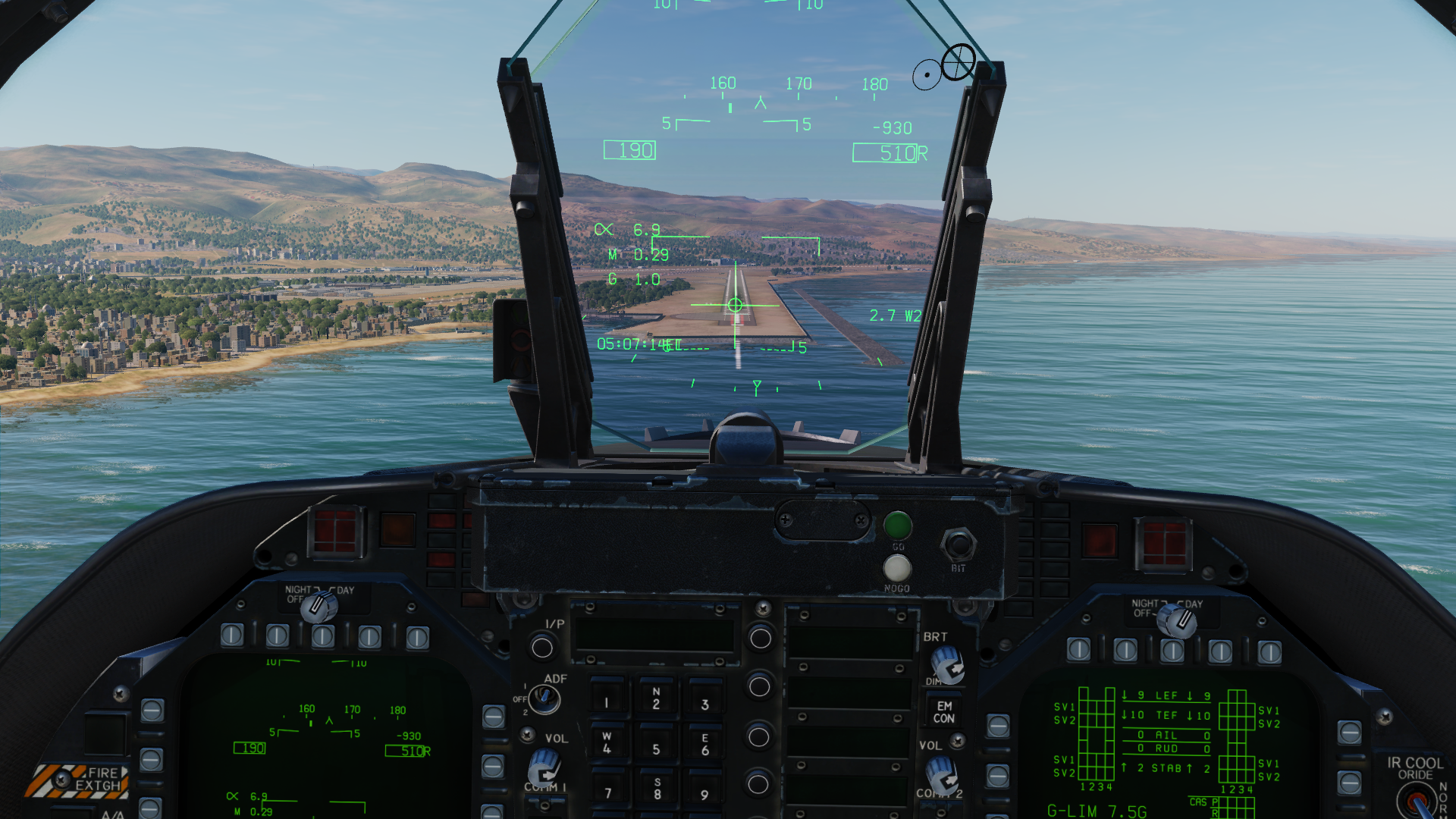
As a follow-up to my old Persian Gulf beacon mod, I have started working on a similar mod for the Syria map. The planned features (so far) are: ICLS beacons for all runways that currently have ILS TACANs colocated witht the GP beacons, giving distance to the touchdown point. The TACAN channel will be paired with the LOC freq. All VOR-DME beacons will be converted to VORTAC. Are there any known ILS sites that are missing from the map? I'm open to user requests, so if there's something you would like added I'll look into it when the points mentioned above are finished. Here's a quick preview, with an ICLS approach to Beirut RWY 16: Download here: https://github.com/adler357/DCS-Syria
-
Sorry. Typo. Kts is correct.
-
The wind threshold is >7 kts.
-
[NO BUG]Incirlik ILS Rwy 23 111.70 not working
drPhibes replied to Davee's topic in Bugs and Problems
The minimum windspeed threshold for ILS interlock is a DCS issue, not not a map issue. ED have been aware of this for a long time and it will hopefully be fixed when the ATC system get an overhaul in the future. -
Do you mean these?
-
https://forums.eagle.ru/showthread.php?t=285180
-
Bad example, since the AKPWS has more aerodynamic drag than a regular Hydra...
-
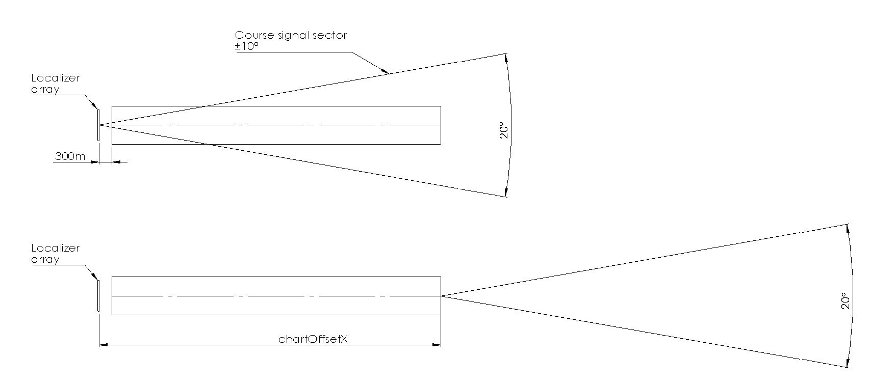
The "chartOffsetX =" parameter moves the ILS coverage sector illustration so that the sectors for opposite runway ends don't overlap. It makes things a bit tidier in the F10 map / ME, but it doesn't affect the simulated signals in any way. Note that it's only really relevant for the localizer, since the GP coverage sector isn't shown.
-
Then the answer is simple: you can't. Every time you update DCS it'll be re-downloaded.
-
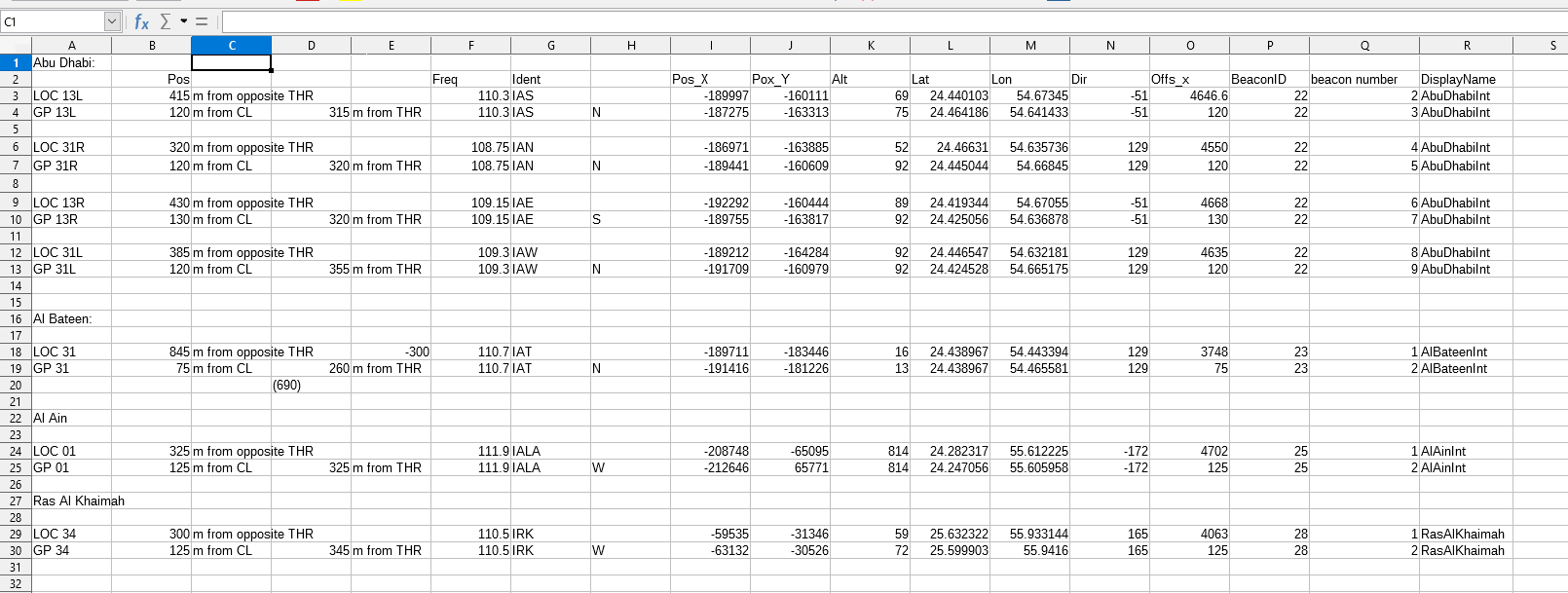
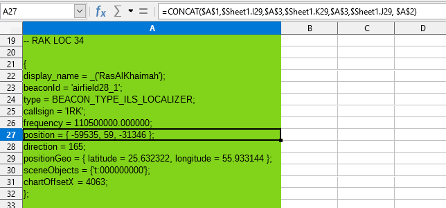
Here's a small behind the scenes peek into how I make new beacons. I made a spreadsheet which simplifies the process a lot, so it basically boils down to a bit of Google Earth and mission editor work: 1. Find an airport that should have ILS, but doesn't in DCS. For the PG map this is quite easy since I have been involved in ILS deliveries to most of the airports in question. An other method is to just check the AIPs for the airports (which is needed anyways, in order to get the correct frequncy and ident, unless you have this info from other sources). 2. Google earth surveying: I find the location of the localizer (LOC) and glide path (GP) antennas and reference their position to the thresholds and centerline of the runway. Google earth coordinates aren't necessarily 1:1 with DCS, so this is the best way I have found of semi-accurately placing the beacons. The positions are noted in collumn B and D in the spreadsheet. 3. I check AIP AD 2.19 to find the LOC frequency and IDs of the navaids. DCS handles the LOC/GP frequency pairing, so there's no need to check the GP freq. in Annex 10. The results are noted in collumn F/G. 4. Collumn H is just a note of where the GP is located in relation to the runway. 5. Collumn I-O: DCS mission editor surveying. I find the points specified in col. B/D in the mission editor, and note down the coordinates in both X/Y metric (I/J) and decimal degrees (L/M), and the elevation in meters (K). N is the runway heading in degrees, referenced to true north, and it ranges from -180° to +180°. So N, E, S and W would be 0, 90, 180, -90. The reason why there are both metric X/Y and lat/lon coordinates is that one defines the placement of the navaid, and one defines the placement of the mission editor/F10 map symbology. Collumn O defines an offset in the localizer coverage symbology, so that it emanates from the opposite runway end. 6. Beacon ID (col. P) is taken from the beacons.lua entries for the airport in question. If no navaids exist at the airport, just chose the next available number. Beacon number (col. Q) is the next available beacon number for the given beacon ID. DisplayName is just used in the LUA to keep stuff organized. When I finish filling out these various parameters, I go on to sheet 2 of the spreadsheet, where I generate the lua code using 'concat', pre-defined strings and the values from sheet 1:
-
Move the contents of the \DCS World\Mods\terrains\Caucasus\ folder to somewhere else, and create a symlink to the new location.
-
AFAIK DCS world is written in C++, not C#.